
Over 100 years ago, just before the First World War, South Australia (SA) began a concerted effort to open up the Mallee region to agriculture, mainly wheat and sheep.
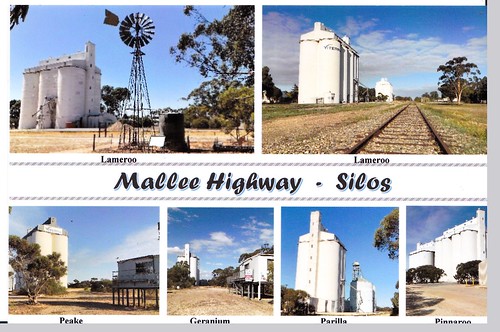
The central hub of the district was Karoonda, established in 1913, growing quickly to become a major rural and commercial centre and rail yard with loading facilities for the vast quantities of grain harvested from the surrounding district, now largely cleared of the slow-growing, stubby eucalypt trees that once dominated the semiarid landscape to the Victorian border and beyond.
Over a period of more than 40 years, I have been driving through the region on my travels, observing the plight of the little towns in this harsh region. While the roads have improved considerably, so has the volume of traffic, particularly grain trucks since the gradual closure of the railway lines that once carried the harvest back to Tailem Bend, through Murray Bridge and on to Port Adelaide for shipment.
"Originally people had to come by horse and dray or foot and the road wasn't all that brilliant for getting easy access,” local Pinnaroo historian, Max Wurfel, told the ABC in a 2007 interview. “The railway really did open up the country (from 1906). It enabled people, particularly woman and children, to come along and for them to get goods in."
The central hub of the district was Karoonda, established in 1913, growing quickly to become a major rural and commercial centre and rail yard with loading facilities for the vast quantities of grain harvested from the surrounding district, now largely cleared of the slow-growing, stubby eucalypt trees that once dominated the semiarid landscape to the Victorian border and beyond.
 |
| The rural silo art project like this example in Karoonda has helped bring tourists back to remote towns in SA (R Eime 2020) |
 |
| The all-but-deserted hamlet of Sandalwood on the Karoonda Highway once had its own railway station (R Eime 2020) |
On the Victorian side, the railway has been fully renovated with sleeper replacement and track maintenance on the 109-kilometre Murrayville-Ouyen corridor line as part of the $440 million Murray Basin Rail Project. That railway line once ran all the way to Tailem Bend in SA, but now stops abruptly just before the border, leaving SA’s rail line languishing and rusting since the last train in 2015.
 |
| Rail lines rust at the abandoned yard at Wanbi. (R Eime 2020) |
Similarly, the numerous spur and branch lines that spread out like tendrils reaching as far as Renmark, Waikerie, Bordertown and Pinnaroo gradually withered, giving over their bounty of wheat and barley to the growing number of trucks. Passenger services had ceased well before the grain trains, with the last passenger services departing Pinnaroo in the 1960s.
 |
| Golden Grain Hotel Established at Pinnaroo in 1906 as The Land of Promise Hotel, rebuilt in 1913 as the Commercial Hotel and was renamed the Golden Grain Hotel in 1958 (R Eime 2016) |
 |
| SA Rail Map 1974 (full size) |
While campaigns to reinstate the rail network have been begun and studies completed, the old rails continue to rust and the weeds grow around the points and sleepers.
 |
| A sad day. The last grain train makes its way west to Tailem Bend. Seen here at Lameroo (c) Michael Phillpott 2015) |
Meanwhile, I still drive the roads and remain fascinated by the slowly changing landscapes and - more often than otherwise - the sad decline of the little towns along the way.
About Australia's Mallee Region:
Australia's Mallee region, spanning parts of South Australia, Victoria, and New South Wales, features semi-arid landscapes dominated by mallee eucalyptus trees. Characterized by sandy soils and low rainfall, it supports unique flora and fauna adapted to arid conditions. Agriculture, including wheat farming and sheep grazing, is prominent in this harsh yet resilient environment.
Australia's Mallee region, spanning parts of South Australia, Victoria, and New South Wales, features semi-arid landscapes dominated by mallee eucalyptus trees. Characterized by sandy soils and low rainfall, it supports unique flora and fauna adapted to arid conditions. Agriculture, including wheat farming and sheep grazing, is prominent in this harsh yet resilient environment.
MORE:
- Mallee Tourist and Heritage Centre, Pinnaroo
- Silo Art Trail in South Australia
- The Mallee Route (2021)
RELATED STORIES:


No comments:
Post a Comment