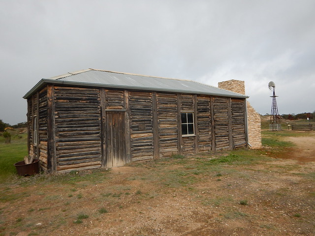
Cowangie is located just off the highway approximately 19 km to the east of Murrayville and it is this area which is known as Kow Plains.
The Kow Plains Homestead is slightly to the southeast of the town and is one of the few surviving colonial homesteads in the Mallee. It is a rough-hewn vernacular building which can be viewed from the highway (there is an identifying sign on the property gate). It has recently been restored and also won an international award for heritage. It is thought to date from around 1867 and may have been built by two Swedish sailors who jumped ship in Adelaide then headed overland in search of work or another theory is that two Chinese were responsible.

Cowangie itself was established 1911, at its peak in the 1930’s had 3 general stores, a baker, butcher, bank, a boarding house, a builder, a barber, a blacksmith shop and a garage. A number of the old buildings are still standing, some of the Pepper trees at the west end of town have plaques with the names of First World War soldiers on these were planted in 1918 an Avenue of Peppertrees in honour of the 52 Cowangie and district men who served in the war
Another identifying feature of the little hamlet is a small roadsign dedicated to Australian motor racing identity, Larry Perkins, whose family hails from the region. Larry's father, Eddie, won the 1956 Round Australia Trial in a VW Beetle.
A gypsum mine to the north, established in 1920, is still operating today. There is a picnic area next to the tennis courts in Lewis Street Park and toilets up the road a little further at the local hall.
The stone building next to the Uniting Church (c.1918) was originally one of Victoria’s first Bush Nursing Centre’s, and the only one still standing.
Text sourced from Murrayville Community site.
For further information go to their site: www.kowplains.com
All material (c) Copyright Traveloscopy.com unless noted otherwise.


No comments:
Post a Comment